Travelling from Perth to Kalgoorlie can be done in one day, but rushing skips over key destinations in the Great Southern. Many travellers face a choice: drive directly, or take the time to stop and see more.
The problem with going too fast is that it limits access to WA's smaller towns, nature spots and regional heritage sites. Families, road trippers and interstate tourists often miss chances to visit national parks, beaches and inland landmarks because of poor planning or tight timelines.
This 9-day itinerary offers a clear route with realistic daily distances and overnight stays. The trip runs from Perth through the Margaret River region, across the south coast, and up to Kalgoorlie before returning inland. Each stop has accommodation, food, fuel and things to do. It is built for a balance of driving and sightseeing without needing to rush or backtrack.
The Route at a Glance
Nine days, roughly 2,100 km of driving, every overnight stop in a town with fuel, food and beds. Three of the nine days involve no long-distance driving at all: they are built in so you actually see the places you came for.
| Day | Leg | Distance | Approx. driving |
|---|---|---|---|
| 1 | Perth to Margaret River | 275 km | 3.5 hrs |
| 2 | Margaret River wine region | local | at your pace |
| 3 | Margaret River to Pemberton | 139 km | 2 hrs |
| 4 | Pemberton to Albany | 240 km | 3.5 hrs |
| 5 | Albany | local | at your pace |
| 6 | Albany to Esperance | 483 km | 5 hrs |
| 7 | Esperance and the Great Ocean Drive | 40 km loop | at your pace |
| 8 | Esperance to Kalgoorlie | 390 km | 4 hrs |
| 9 | Kalgoorlie to Perth | 593 km | 7 hrs |
Day 1: Perth to Margaret River (275 km)
The drive to Margaret River takes around 3.5 hours via the Bussell Highway. It is a sealed road suitable for all vehicle types, with service stations and rest stops along the way. Leaving Perth early allows time for a full afternoon in the region.
Margaret River offers several coastline stops between Cape Naturaliste and Cape Leeuwin. While the area is known for surfing, there are also safe swimming beaches and lookout points. Families or non-surfers can visit Ngilgi Cave or walk to Cape Naturaliste Lighthouse, both located near Yallingup.
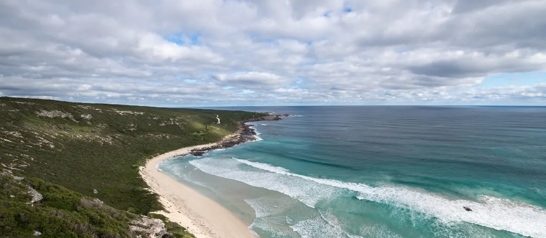
Accommodation is available in town and along the coast, including motels, cottages and caravan parks. It is worth staying at least one night to break the journey and allow time for local food and beach access.
Mobile coverage is stable in most areas, but reception may drop between towns. Fuel is available in Busselton and Margaret River. Booking ahead during peak seasons ensures availability for larger groups or families.
Day 2: Margaret River Wine Region
Margaret River is a major wine-producing area with over 200 vineyards. It accounts for more than one quarter of Australia's premium wine output, with cabernet sauvignon and shiraz as key varieties. Many wineries are open to visitors and include tasting rooms, small restaurants and retail shops.
Self-guided visits are common, with maps available at the Margaret River Visitor Centre. Several routes are signposted and include stops with parking and food options. Organised wine tours are also available for those who prefer a set itinerary or transport.
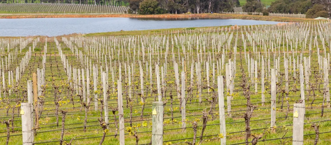
Some vineyards operate on reduced hours or require bookings, especially for large groups or weekend visits. Check online or call ahead before visiting. Non-drinkers can still enjoy the views and local produce, as many cellar doors serve regional foods and non-alcoholic options.
Accommodation remains the same as Day 1. Some vineyards offer overnight stays with onsite cottages or guest rooms. Wi-Fi and mobile reception vary across rural locations but are generally available near town.
Day 3: Margaret River to Pemberton (139 km)
The direct drive from Margaret River to Pemberton takes about two hours, though the worthwhile stops along the way can extend the travel time. The key stop is Cape Leeuwin Lighthouse, where the Southern and Indian Oceans meet. Entry fees apply for tours, and onsite parking is available.
Continue inland to Manjimup, known for fruit production and truffle farms. During truffle season (June to August), visitors can join scheduled hunts at local truffieres. These sessions are guided and usually require bookings in advance.
Arriving in Pemberton, travellers will find a mix of timber history, forest trails and local food venues. The town has several accommodation options including cabins, motels and caravan parks. Visitor information is available at the Pemberton Discovery Centre.
Fuel is available in Manjimup and Pemberton. Mobile coverage is stable near towns but may drop in forested areas. Roads are sealed, and standard vehicles are suitable for all routes covered on this day.
Day 4: Pemberton to Albany (240 km)
The drive to Albany takes around 3.5 hours, but the stops make this a longer day. Start with Walpole-Nornalup National Park, home to the Valley of the Giants Tree Top Walk. This elevated walkway runs through karri and tingle trees and is suitable for most ages. Entry tickets are required and available on site.
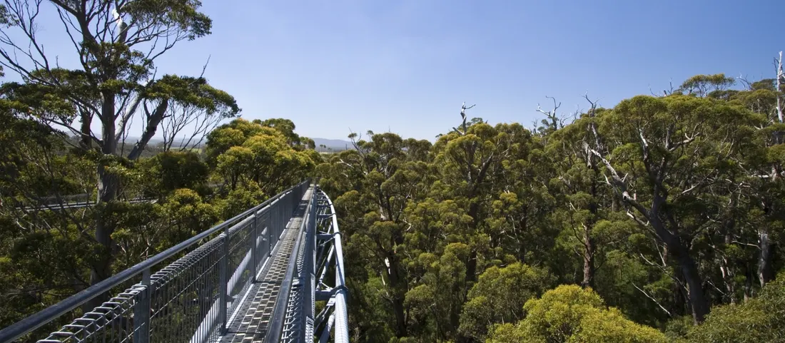
Nearby, Gloucester National Park offers access to the Dave Evans Bicentennial Tree. The climb is not recommended for those with height concerns, but it provides a high viewing point over the forest. Caution is required, and weather conditions may affect access.
Continue east toward Denmark for a stop at Greens Pool. This beach has calm conditions and shallow entry, which suits children and low-impact swimmers. Parking and basic facilities are available, but it can be crowded during holidays.
Albany offers multiple accommodation types, from motels to holiday units. Booking ahead is advised during weekends and school breaks. Fuel, food and mobile coverage are reliable throughout this section.
Day 5: Albany
Albany is Western Australia's oldest colonial settlement and has a mix of historical, coastal and natural attractions. A full day here allows time to explore the area without backtracking or rushing.
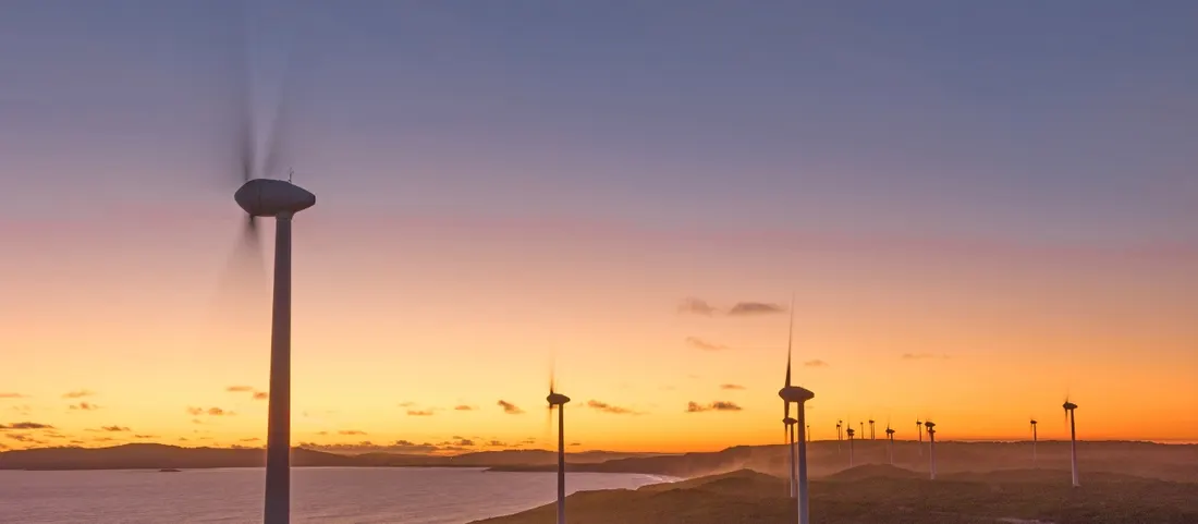
Popular sites include The Gap and Natural Bridge in Torndirrup National Park. These are accessible by sealed road and have fenced viewing platforms. Nearby, the Albany Wind Farm has walking trails and lookouts across the coastline.
For indoor activities, the Historic Whaling Station (formerly Whale World) has exhibitions on Albany's whaling past, including a preserved whale chaser ship, multimedia displays and guided tours. The National Anzac Centre is nearby and focuses on Australia's World War I military history.
Albany has supermarkets, restaurants and visitor services. Accommodation options are varied, including self-contained stays and family motels. Check hours and entry costs for each attraction, especially during public holidays.
Fuel and mobile reception are reliable. Roads to major sites are sealed and suitable for standard vehicles.
Day 6: Albany to Esperance (483 km)
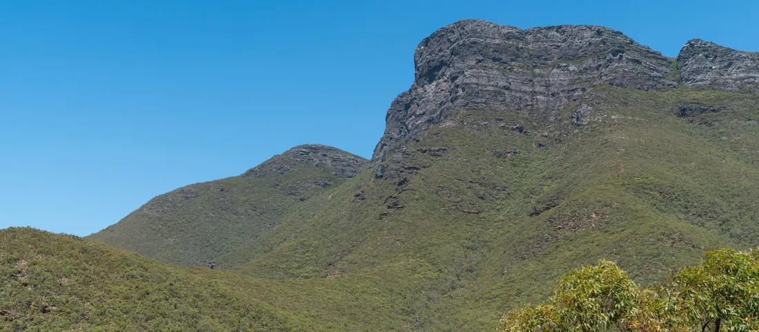
This is one of the longest driving days, with around five hours needed to reach Esperance. Leaving early allows for detours and rest stops. The route passes Stirling Range National Park, home to Bluff Knoll, which stands 1,095 metres above sea level.
Bluff Knoll is accessible to most travellers, though the walk is steep and takes three to four hours return. Weather can change quickly, so carry warm clothing and check local forecasts. Entry fees apply to the park and are payable online or at designated points.
There are limited services between Albany and Esperance, so it is best to refuel in towns like Jerramungup or Ravensthorpe. Mobile coverage is limited in some areas along the drive.
Accommodation in Esperance includes hotels, motels and beachfront caravan parks. Booking ahead is advised during peak periods and school holidays. Roads are sealed and suitable for all vehicle types, though some coastal detours may include gravel surfaces.
Day 7: Esperance
Esperance offers coastal access, nature walks and short scenic drives. Begin early to allow time for the 40-kilometre Great Ocean Drive, which loops past several beaches including Blue Haven, West Beach, Twilight Beach and Salmon Beach. Each stop has parking and beach access, though some locations have limited facilities.
Cape Le Grand National Park is east of town and includes walking trails, granite outcrops and Lucky Bay. Entry fees apply, and sealed roads provide access to the main sites. Wildlife sightings, including kangaroos on the beach, are common in this area.
On the return loop, Lucky Bay Brewing is a local venue offering small-batch beer. It opens daily with changing hours depending on the season. Check ahead if visiting outside weekends or holiday periods.
Finish the day with a drive past Pink Lake. The colour varies depending on algae levels and weather, and it is not always visibly pink. Signage explains the lake's environmental changes.
Esperance has multiple fuel stations, shops and medical services. Mobile coverage is available in town and at most beach stops.
Day 8: Esperance to Kalgoorlie (390 km)
The inland drive to Kalgoorlie takes about four hours via Norseman. This sealed route is used by freight and regional travellers, with limited fuel and food stops. Refuel in Esperance and carry water, especially in warmer months.
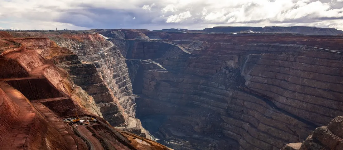
Kalgoorlie is a major mining centre with historical and industrial points of interest. The Super Pit viewing platform shows the scale of open-cut mining and is accessible by car. Guided tours are also available but may require bookings.
Lake Ballard is northwest of Kalgoorlie and features a large outdoor art installation by Antony Gormley. The site is remote and requires a separate detour, best suited to those with more time or 4WD access.
In town, the WA Museum Kalgoorlie-Boulder and the Royal Flying Doctor Service Visitor Centre offer insight into the region's gold rush and remote healthcare services. Local galleries display works by Aboriginal and Goldfields artists.
Accommodation ranges from motels to serviced apartments. Fuel, mobile coverage and visitor services are widely available.
Day 9: Kalgoorlie to Perth (593 km)
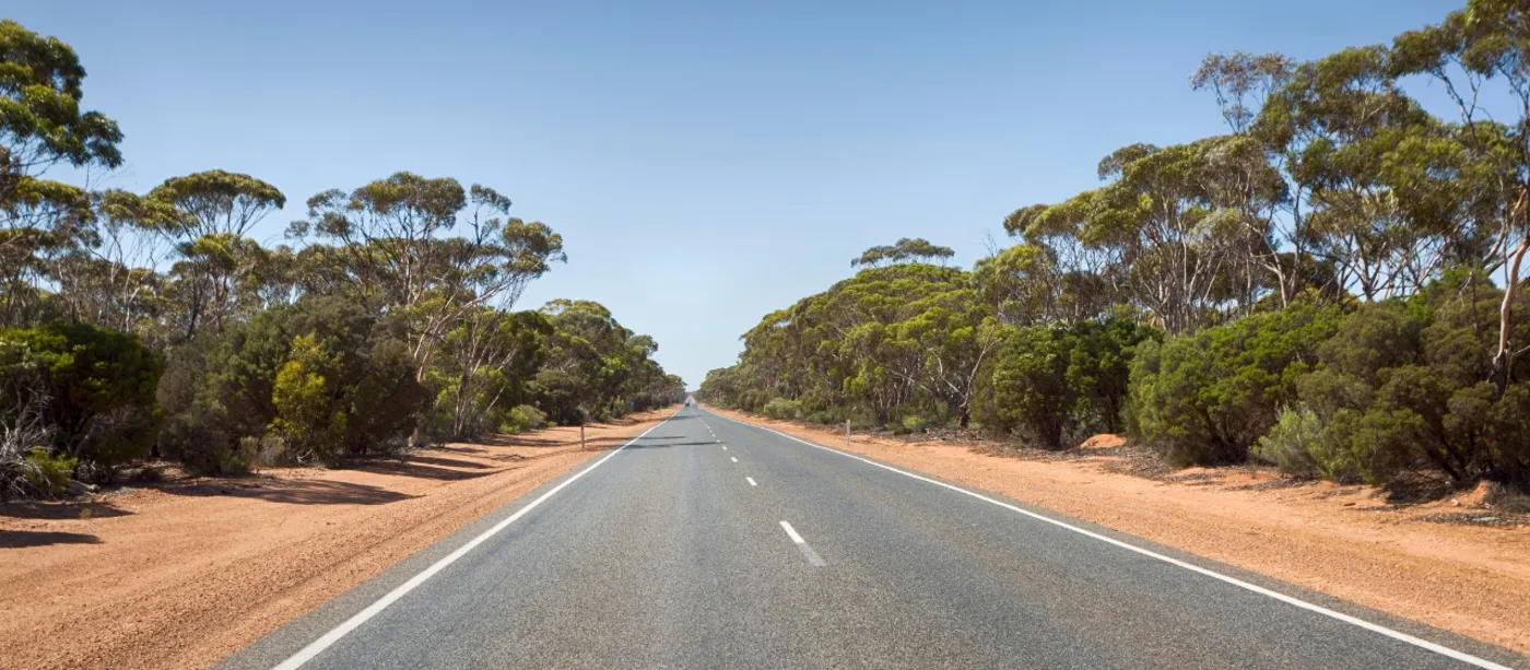
The return to Perth is a full-day drive of approximately seven hours. The most direct route travels west via Coolgardie, Southern Cross, Merredin and Northam. These towns offer fuel, food and basic services, making them suitable for rest breaks and refuelling.
Road conditions are sealed and maintained, with minimal elevation changes. Traffic is typically light outside freight times. Mobile reception is available through most of the route, with some gaps between smaller towns.
Coolgardie is a historic site with preserved gold rush buildings and small local museums. Southern Cross and Merredin have petrol stations and cafes. Northam is the final stop with full town services before reaching the Perth metro area.
Drivers should plan for fatigue management and take scheduled breaks every two hours. Some accommodation is available in Merredin for those who wish to split the return journey over two days.
Vehicle checks before departure from Kalgoorlie are recommended due to the long travel distance and limited roadside support in some areas.
Where to Stay Along the Route
Each overnight stop on this itinerary has a mix of motels, holiday parks and private cabins. Book ahead to secure availability, especially during busy travel periods.
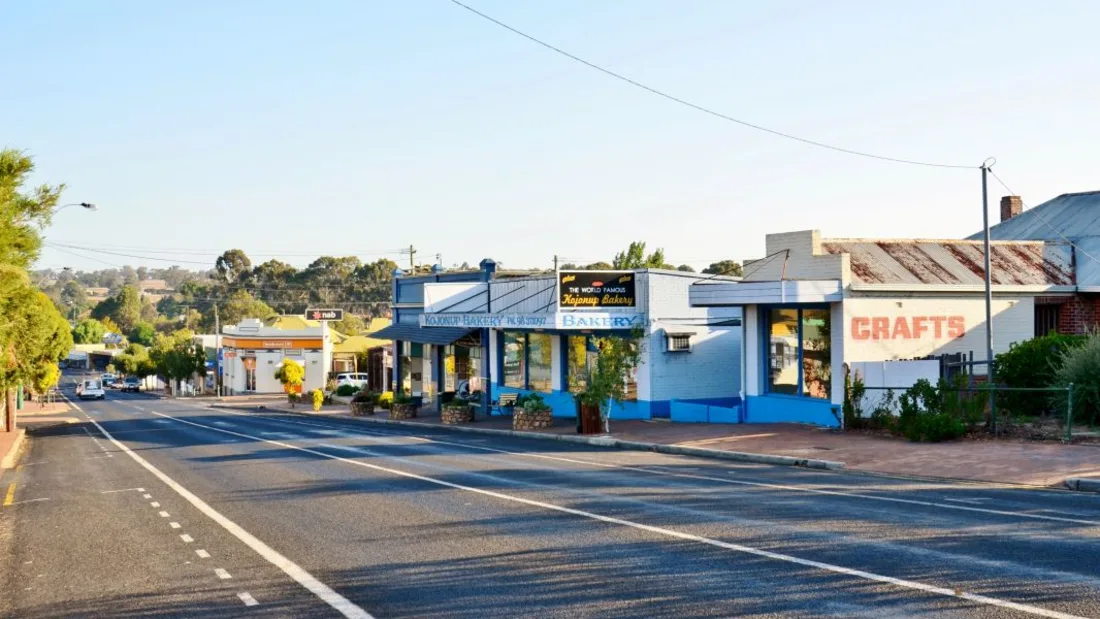
There is also a well-worn variation on this loop worth knowing about: taking the Albany Highway directly between Perth and Albany instead of the forest-and-coast run through Margaret River and Pemberton. It works as the opening leg southbound (joining this itinerary at Albany on Day 4), or as the route home if you are doing the southern half of the trip only. On that road, Kojonup is the natural overnight break, sitting roughly halfway: 250 km from Perth and 160 km from Albany.
Cornwall House Accommodation is right on the Albany Highway in the centre of Kojonup, at 70-72 Albany Hwy. Rooms are air-conditioned with ensuite, free WiFi, tea and coffee making facilities and a fridge, with a shared camp kitchen and free onsite parking. Contactless check-in is available from 2pm, so a slow day of stops costs you nothing at the other end. Our Perth to Albany drive guide covers that leg stop by stop, and the Kojonup dining guide has dinner sorted, starting with the Royal Hotel across the road.
Check availability and book Call us (08) 9831 0214
To make a booking or enquiry, you can also contact us through the website.
Frequently Asked Questions
How long does it take to drive from Perth to Kalgoorlie directly?
The direct run between Perth and Kalgoorlie is about 593 km via Northam, Merredin, Southern Cross and Coolgardie, roughly seven hours of driving on sealed highway. It can be done in a day, but plan a proper break every two hours; Merredin has accommodation if you would rather split it over two days.
How many days do I need for this itinerary?
The loop is built for nine days: six driving days and three days with no long-distance driving (the Margaret River wine region, Albany and Esperance). You could compress it by cutting the rest days, but those days are the reason to take this route instead of driving straight up the Great Eastern Highway.
Do I need a 4WD?
No. Every leg of this itinerary uses sealed, maintained roads suitable for standard vehicles. The exceptions are optional detours: some coastal side tracks near Esperance include gravel, and the Lake Ballard art installation northwest of Kalgoorlie is remote and best suited to travellers with more time or 4WD access.
Where should I refuel between Albany and Esperance?
The Albany to Esperance leg is the longest of the trip at 483 km, with limited services along the way. Refuel before leaving Albany and top up at Jerramungup or Ravensthorpe. Mobile coverage is patchy on this stretch, so download offline maps before you set out.
Can I include an overnight stop in Kojonup on this trip?
Yes. If you start or finish the loop with the direct Albany Highway run between Perth and Albany, Kojonup sits almost exactly halfway: 250 km from Perth and 160 km from Albany. Cornwall House Accommodation is on the highway in the centre of town, with contactless check-in from 2pm for late arrivals and free onsite parking.